GEOTECHNICAL ENGINEERING
SAINT JOHN NB
HomeUnderground ExcavationsGeotechnical excavation monitoring

Geotechnical Excavation Monitoring in Saint John NB: Precision for Complex Urban Ground

Knowledgeable. Thorough. Resourceful.

LEARN MORE

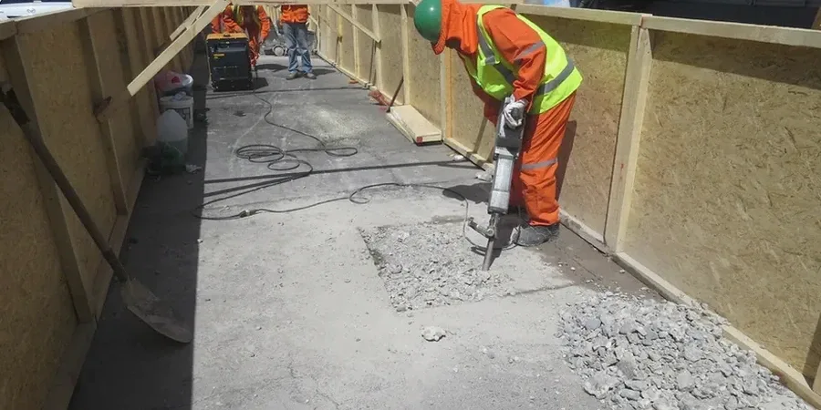
Saint John’s urban fabric is a direct reflection of its glacial and marine geology. The old Loyalist grid was laid out on a steep, rocky peninsula, while later industrial expansion pushed onto harbour fill and post-glacial marine clays near the Courtenay Bay causeway. That layered history means today’s construction sites encounter drastically different ground conditions within a single block. A deep excavation on Prince William Street might hit bedrock at three metres, while one near the port deals with saturated silts and old timber cribbing. Without continuous geotechnical excavation monitoring, surprises come fast and expensive. We provide that data stream — vibration thresholds, lateral movement, pore pressure shifts — so that shoring design and construction sequencing adapt before a problem becomes a failure. For projects requiring supplementary investigation, the same team can deploy test pits to physically verify backfill composition or MASW surveys to map shear-wave velocity profiles across the site without disturbing sensitive adjacent structures.

In Saint John, the difference between a routine excavation and a costly setback is often just a few millimetres of undetected wall deflection in the marine clays.

Our service areas

Our approach and scope

The local geology is dominated by the Precambrian and Cambrian bedrock of the Caledonia Highlands, blanketed by a thin and highly variable veneer of glacial till, then overlain in the lower city by thick sequences of Leda clay and marine silt deposited when the region was submerged post-glaciation. In the uptown area, the depth to bedrock is often less than 5 metres, but the clay pockets in the central peninsula can exceed 20 metres and are prone to creep when unloaded. This is not a city where you can rely on textbook cut-slope angles. Monitoring here requires an instrumentation plan calibrated to rapid transitions: we might use a combination of inclinometer casings to track shear zones in the stiff clay, load cells on tieback anchors for a soldier pile wall, and seismographs to keep vibrations from blasting within the limits defined by the NBCC. Because Saint John sits at the northern edge of the Fundy Basin, microseismic activity is a real factor, and our approach follows CSA A23.3 guidelines for concrete structures in seismic zones while incorporating ASTM D6230 for inclinometer resolution. For deep cuts near heritage buildings, integrating a CPT test prior to the dig provides the continuous stratigraphic profile that displacement monitoring then validates during construction.
Geotechnical Excavation Monitoring in Saint John NB: Precision for Complex Urban Ground
Technical reference — Saint John NB

Local geotechnical context

The Bay of Fundy isn’t just about tides — it’s about a maritime climate that saturates the ground for weeks in spring and freezes it hard in January. That freeze-thaw cycling in Saint John’s fissured clays can open hairline cracks that quietly change the groundwater regime around an open cut, increasing hydrostatic pressure on shoring walls overnight. Then there’s the fog: dense marine fog rolling off the bay cuts visibility on site and delays the daily optical survey readings that many contractors rely on; an automated total station with telemetry solves that, pushing data to the engineer’s dashboard regardless of weather. Excavation near the harbour introduces another variable — tidal fluctuation up to 8 metres can affect pore water pressures in granular fills, so we often pair vibrating wire piezometers with a real-time telemetry setup. To address the risk of bottom heave in deep clay cuts, the data feeds directly into stability analysis that may recommend slope stability reinforcement or a revised excavation sequence before the excavation reaches final grade.

Need a geotechnical assessment?

Reply within 24h.

Email: info@geotechnical-engineering.org

Watch the video

Regulatory framework

NBCC 2015 (National Building Code of Canada, seismic provisions), CSA A23.3-14 (Design of concrete structures in seismic zones), ASTM D6230-13 (Inclinometer and lateral movement monitoring), CSA S832-14 (Seismic risk reduction of operational and functional components), ISO 18674-1:2015 (Geotechnical monitoring by field instrumentation)

Technical data

ParameterTypical value
Lateral wall deflection (inclinometer precision)±0.25 mm/m per ISO 18674-1
Vibration monitoring thresholdPPV limits per NBCC and CSA S832
Pore pressure range (standpipe/VW)0–1000 kPa, accuracy ±0.1% FS
Load cell capacity for anchors/strutsUp to 2000 kN, ±0.5% accuracy
Settlement point resolution±0.1 mm via digital level loop
Automated total station (ATS) frequencyConfigurable 15 min – 4 hr cycles
Typical bedrock depth in Uptown Saint John3–8 m below grade, variable

Quick answers

What kind of instrumentation does a typical excavation monitoring plan in Saint John include?

It depends on the cut depth and ground conditions, but a typical plan for a 6-metre excavation in the central peninsula would include inclinometer casings behind the shoring wall to measure lateral deflection, load cells on anchors or struts, vibrating wire piezometers to track pore pressure in the marine clays, and an automated total station for surface settlement points. If blasting is required near Uptown buildings, seismographs are added to the perimeter.

How much does geotechnical excavation monitoring cost in the Saint John area?

For a standard excavation in the greater Saint John region, monitoring packages typically range from CA$1,140 to CA$3,410 per month depending on the number of instruments, the frequency of manual readings versus automated telemetry, and the duration of the project. A fixed-price proposal is prepared after reviewing the shoring design and the site-specific geotechnical report.

How quickly can monitoring data be accessed if a critical threshold is exceeded?

For automated systems, readings are pushed to a cloud dashboard in near real-time, and automated SMS or email alerts are triggered the moment a sensor exceeds its predefined threshold. Manual readings are processed and distributed within 24 hours. In Saint John, we configure alarm thresholds specifically for the local Leda clay sensitivity and the NBCC vibration criteria, so the response is tuned to actual risk, not generic limits.

Location and service area

We serve projects in Saint John NB and surrounding areas.

View larger map